
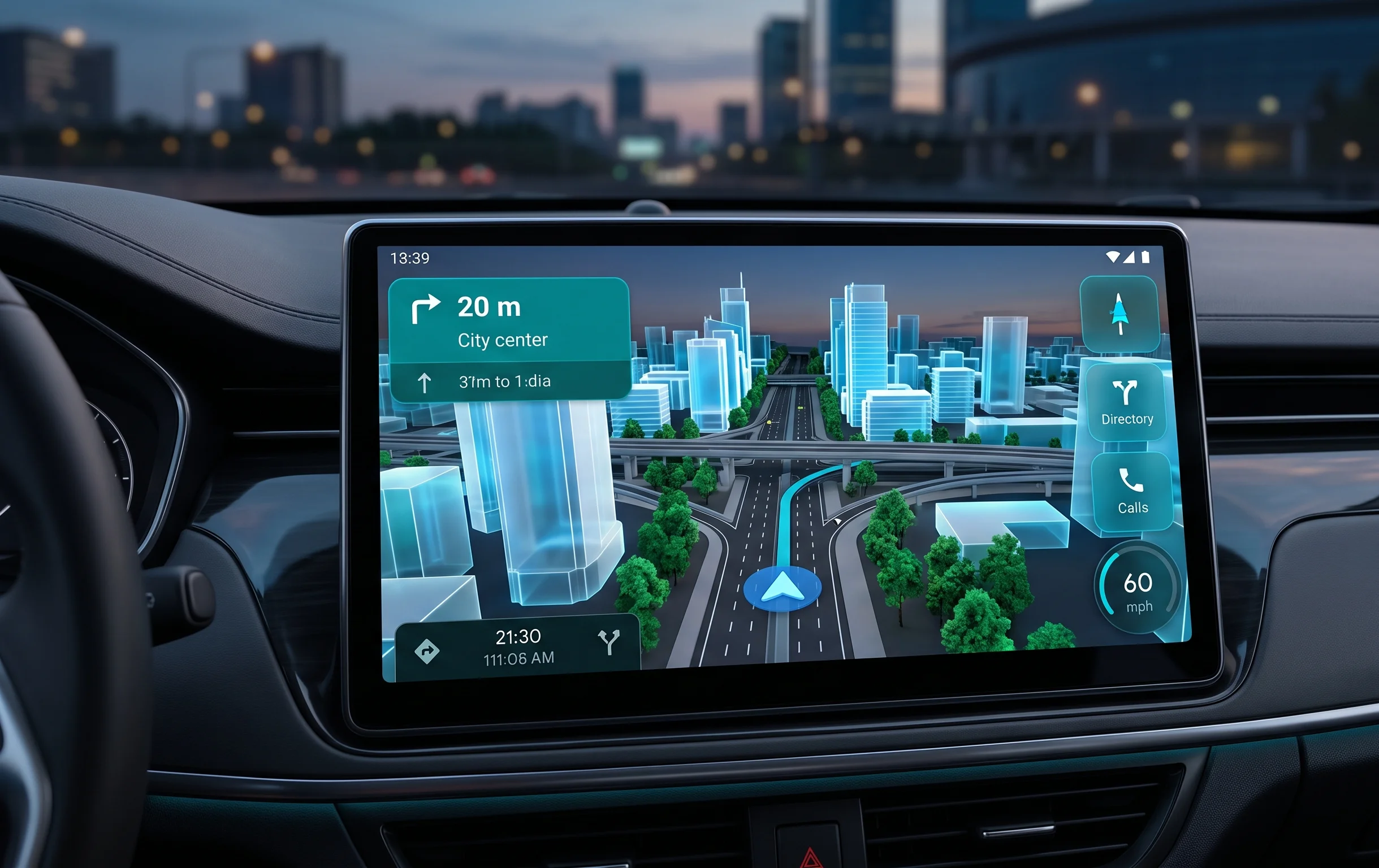
A New Era in Automotive Navigation by Google
Google has initiated a large-scale rollout of an updated interface for the Android Auto platform. The main modification involves transitioning to the Immersive Navigation framework within the Google Maps application. This major software update is designed to reshape how drivers perceive the road environment by integrating interactive three-dimensional entities. Users of in-car infotainment systems will now experience a highly detailed visual presentation, substantially improving orientation within metropolitan areas and complex highway systems.
The core concept of this release centers around maximizing synchronization between what the driver sees on the dashboard display and the real-world view through the windshield. Developers moved away from traditional flat representations of urban areas, choosing instead three-dimensional models featuring dynamic transparency adjustments during travel.
Main Innovations and Technical Aspects of the Interface
The updated navigation structure relies on real-time object rendering. Among the key elements of the overhauled interface, several architectural updates stand out:
- Three-dimensional textured buildings. All significant architectural structures in major urban locations are now displayed with respect to their approximate height and shape. To prevent structures from obstructing the road view or the path trajectory, an automatic translucency algorithm was developed. When the vehicle icon approaches a building, the object smoothly becomes semi-transparent.
- Detailed multi-level interchanges. Complicated engineering structures such as overpasses, bridges, exits, and multi-level junctions received distinct spatial separation. The system precisely defines which highway level the vehicle occupies at any given moment, minimizing the chance of missing a turn.
- Infrastructure and greenery layout. The maps started showing pedestrian walkways, lane boundaries, and volumetric tree models along the driving path. This improves environmental context perception, particularly in unfamiliar areas.
- System version updates. The features are integrated into the latest maps builds, bringing desktop-grade detail levels directly into vehicles.
Impact of 3D Rendering on Smartphone Hardware Components
Since Android Auto projects the interface from a connected mobile device directly to the car screen, processing three-dimensional graphics creates an additional load on the smartphone CPU and GPU. During extended navigation usage with active 3D buildings, a notable rise in device operating temperatures can occur.
Considering the increased thermal output, drivers are advised to utilize a wired connection or place the smartphone near the climate control vents to avoid thermal throttling during long summer journeys.
How to Enable and Configure the New Display Mode
The distribution of this feature occurs gradually via Google server-side updates, meaning that updating the app via the Google Play Store to the latest build is necessary but might not trigger immediate availability. Users can check for the feature within the application configuration menu right on the vehicle main screen.
To optimize performance, a dedicated toggle to deactivate 3D structures is included for users who prefer a classic look or want to minimize mobile phone energy consumption. Complete availability across all compatible hardware setups is expected within the upcoming weeks.


0 Comments